https://komonews.com/news/local/storm-survey-team-heads-to-gauge-damage-from-port-orchard-tornado
According to the NWS Seattle office, the tornado produced EF2 damage to homes in a neighborhood and also a storage facility. While the tornado track was relatively short, it was as wide as 300 yards. This event is the latest in several notable fall and early winter tornadoes that have occurred in western WA and northwest OR in recent years and is similar in strength to one that formed in the Pacific Ocean and came ashore to strike Manzanita, OR in October of 2016.

Where did this tornado come from and was the threat predictable? Tornadoes are exceptionally rare in this part of the world; on average, only 1-2 occur in western Washington in a year. So there are not very many cases in which to build a rich repository of cases in which to build an analysis of common tornado-producing patterns. This means we have to depend on detecting the ingredients favorable for producing tornadoes. The tough part of this is that we don't know all the ingredients for tornadoes and even if we did, some may require observations that just aren't available to us on an operational basis. Even in the traditional tornado alley, it's difficult to determine what exactly happened to create tornadoes in any one event.
This case is no different in its marginal characteristics and didn't express the kind of predictability that operational meteorologists depend on to make a confident forecast. The Storm Prediction Center only forecasted general thunder in their morning and midday severe weather outlooks. This is, after all, the time of year when cold upper-level systems combine with the mild Pacific Ocean sea surface temperatures to generate instability, and this day was a classic case. Enough instability to generate convection is one thing, but a tornado friendly environment? SPC isn't anticipating one. The base situational awareness of forecasters and the public would likely be starting from a relatively low point.
But I don't think this event was undetectable, nor even unpredictable, and we have surface observing networks, model analysis, GOES data, and especially a WSR-88D not too far away. Some of these data suggest that it would be possible to ramp up situational awareness quickly when the evidence appears to show that the morning forecast was understating the threat. Let's assume the first indications that the environment may be favorable for tornadoes comes from the behavior of the storms themselves.
The first indication likely appeared from the development of the first detectable radar-observed signatures of rotation aloft. By far, of all storm types, supercells provide the precursor signatures with the most predictability. Squall line mesovortices can provide some predictability but with less lead time. And nonmesocyclonic tornadoes (aka landspouts) often provide no precursor signatures from radar at all. So, in this case, was there evidence of a supercell responsible for this tornado?
Here is the KATX WSR-88D radar loop for the two hours leading up to the tornado. This four-panel loop started near noon PST (labeled here 1:59 pm CST in the reflectivity panel). The parent cell of the tornado first appeared around an hour later, or 1 pm PST near Skokomish, WA. Already the half degree velocity appears to show some positive shear. Another 27 minutes had to pass, or by 1:32 pm PST before the radar indicates that the parent cell strengthened enough to produce a real mesocyclone signature with a rotational velocity of 40 kts (This lesson on WDTD's home page describes a mesocyclone and how to measure rotational velocity). At about the same time the differential reflectivity showed the onset of high Zdr values accompanying the reflectivity core. The half degree beam from KATX centered around 1.2 km above the radar. High Zdr values in high reflectivity most likely show large raindrops. But at the next elevation scan up, around 2.1 km, the same high Zdr values appeared at this time and here the surrounding values dropped. The Quillayute, WA sounding that morning showed the melting level around 1.4 km. This was likely a Zdr column, a common sign of an updraft transporting liquid droplets above the melting layer. These two features, updraft, and a mesocyclone persisted for 30 minutes with only minor fluctuations as the storm approached Port Orchard. A cell with a persistent mesocyclone and updraft fits the description of a supercell. The only feature not readily apparent is the absence of some kind of hook echo or a low-level reflectivity notch. I'm not surprised we don't see these features since this storm was quite small, both vertically and horizontally.
 |
| A radar loop over the two hours leading up to the tornado from the WSR-88D KATX. The reflectivity appears in the upper left, base velocity in the upper right, differential reflectivity (Zdr) in the lower right, and correlation coefficient (CC) in the lower left. |
 |
| The Quillayute, WA sounding from 2018 Dec 18 12 UTC. |
Accoing to the latest tornado warning guidance quick guide, 25% of mesocyclones with a rotational velocity of 40 kts are associated with tornadoes. This is pretty high, and achieves the highest skill if the decision is made to classify this mesocyclone as tornadic when it reaches this rotational velocity. But there is a significant disclaimer. The guidance makes no mention of the environmental conduciveness to creating a tornado. Plenty of atmospheres can produce supercells but with no capability to generate a significant tornado threat. While the guidance was taken from environments with tornado watches, was this environment worthy of seriously considering this guidance? Well, the morning sounding shows a few signs that say yes, and a couple that gives me pause.
 |
| The left chart shows the probability of a mesocyclone being tornadic with a given low-level vortex signature strength presented by low-level differential velocity in m/s (LLDV) or rotational velocity in kts (LLRV). The right panel indicates the Heidke Skill Score should the decision be made that the given mesocyclone is tornadic as a function of LLDV and LLRV. The sources of information come from a 2003 Tornado Warning Guidance (TWG), a WDTD study, and Smith and co-authors in 2015. The purple filled circle with a black border represents the rotational velocity of the Port Orchard mesocyclone at 1332 PST. |
First, the good signs. The most favorable sign was a rather impressive 35 kts of bulk wind difference in the lowest 3 km above the surface, 21 kts in the lowest one kilometer (bulk wind difference is a very simplified representation of a more proper shear measurement). Even more impressive, the shear direction sharply bent clockwise almost 90 degrees at roughly one km. The hodograph looked quite similar to that of many tornado-producing profiles found in multiple composite studies. The low-level 'sickle shape' of the hodograph permits a large amount of streamwise vorticity to be ingested into any convective updraft that manages to form. Two authors, John M. Esterheld and Donald J. Giuliano, studied the association between the low-level shear orientation and the storm-relative low-level wind and the categorization of supercells from nontornadic to significantly tornadic. That angle is what's called the critical angle, and a value of 90 degrees would lead to having all of the horizontal vorticity represented by the shear to be streamwise. The critical angle appeared to be the nearly 90 degrees for the Quillayute sounding.
On the other hand, the feature giving me pause was that the thermodynamic profile barely showed any instability. One representation of instability, CAPE, only yielded a meager 134 j/kg, and that's the maximum version available based on the morning sounding at Quillayute. This amount was well below anything that the tornado warning guidance can offer as enough to generate a strong enough updraft for a supercell. I would be looking for more before considering a reasonable prospect to generate a strong enough updraft. The only positive attribute to the thermodynamics was that the low-level lapse rate was somewhat high, or in other words, there was not much convective inhibition. But the presence of the storm in the afternoon surely pointed to more instability being available to the south and east of the Olympics than what the sounding showed. Sure enough, the Regional Atmospheric Prediction (RAP) model painted a more unstable picture with nearly 280 j/kg of uncapped CAPE using a 100 mb deep mixed layer parcel from a 22 UTC analysis at a point near the storm's location. A 100mb layer may be asking a lot for a storm who's depth was only 6 km. Thus I checked the surface-based CAPE and it was 490 j/kg. Perhaps the optimal layer from which a parcel may be drawn would be in the lowest 50 mb, but I think you get the picture that adequate CAPE appeared to be available.
 |
| The RAP sounding near Port Orchard valid 2018 Dec 18 22 UTC. |
The 0-3 km bulk wind difference and the storm-relative helicity in the 0-1 km and the 0-3 km layers were higher in this RAP sounding than for the Quillayute sounding. Though the critical angle was less the component of the low-level shear oriented perpendicular to the 10 m storm-relative flow was still quite high. And perhaps it's quite likely that the actual hodograph shape may have had a higher critical angle. BTW, the critical angle, and the strength of the lower level shear really point to the fact that the streamwise vorticity was quite high. Any mechanism to tilt such vorticity would readily produce a low-level mesocyclone, even for storms not deviating to the right. The last severe storms conference in Stowe VT featured several studies of different types that indicated that we should pay more attention to streamwise vorticity. As an aside, we appeared to be circling back to this parameter since it's importance in producing mesocyclones was first studied by Robert Davies Jones in the early 1980s.
Okay, I only showed two sounding points, and one was from 12 UTC. But what was the spatial pattern of the environment capable of producing supercells and tornadoes? According to the 1-hour forecast of the 21 UTC RAP, Supercell Composite Parameter (SCP), most of western Washington State, and offshore areas had the potential for supercells. The only area not favorable was located in the northeast Olympic Penisula and north, where both the deep layer vertical wind shear and CAPE were lacking in the RAP analysis. The SPC formulation of the Significant Tornado Parameter (STP) was below 1 in all areas except for coastal Oregon where CAPE was high enough to keep the parameter above 1. The RAP sounding above showed that the mixed layer CAPE likely brought down the STP to 0.2 but the fixed layer STP, which depends on surface-based CAPE, was higher. Again, sometimes mixing the lowest 100 mb of the atmosphere may be too much to ask when we're talking about a shallow convective layer such as this day. This even was not the first time that a significant tornado developed with barely any effective layer STP but higher fixed layer STP.
 | |
|
 |
| Above, the 21 UTC 1 hr RAP forecast of fixed layer Significant Tornado Parameter. |
The KATX radar was fortunately close enough to depict a supercell with a mesocyclone strong enough to have perhaps a 30% chance of a tornado provided the environment supported the possibility of tornadoes. The morning Quillayute sounding and the afternoon modified RAP analysis sounding showed hodograph profiles, sufficient CAPE, and low enough CIN to be favorable for tornadoes. I won't even consider whether the boundary layer relative humidity was sufficiently high. The environment had high relative humidity in the lowest 3 km and all soundings showed dewpoint depressions of only a few degrees at the surface.
Sometimes we need a little convincing that what appears to be favorable ingredients for rotating storms actually produced something elsewhere. Well, it appeared this supercell was not the only one in the area. The Multi-Radar/Multi-Sensor (MRMS) depicted another mesocyclone track in the Pacific that occurred a couple of hours earlier.
 |
| The MRMS rotation tracks product accumulated over six hours ending at 23 UTC 18 Dec 2018. A strong mesocyclone track appeared offshore west of the mouth of the Columbia River. The other, southeast of the Olympics. |
 |
| The HREF surface-based CAPE member plot valid 18 Dec 2018 22 UTC |
 | |
|
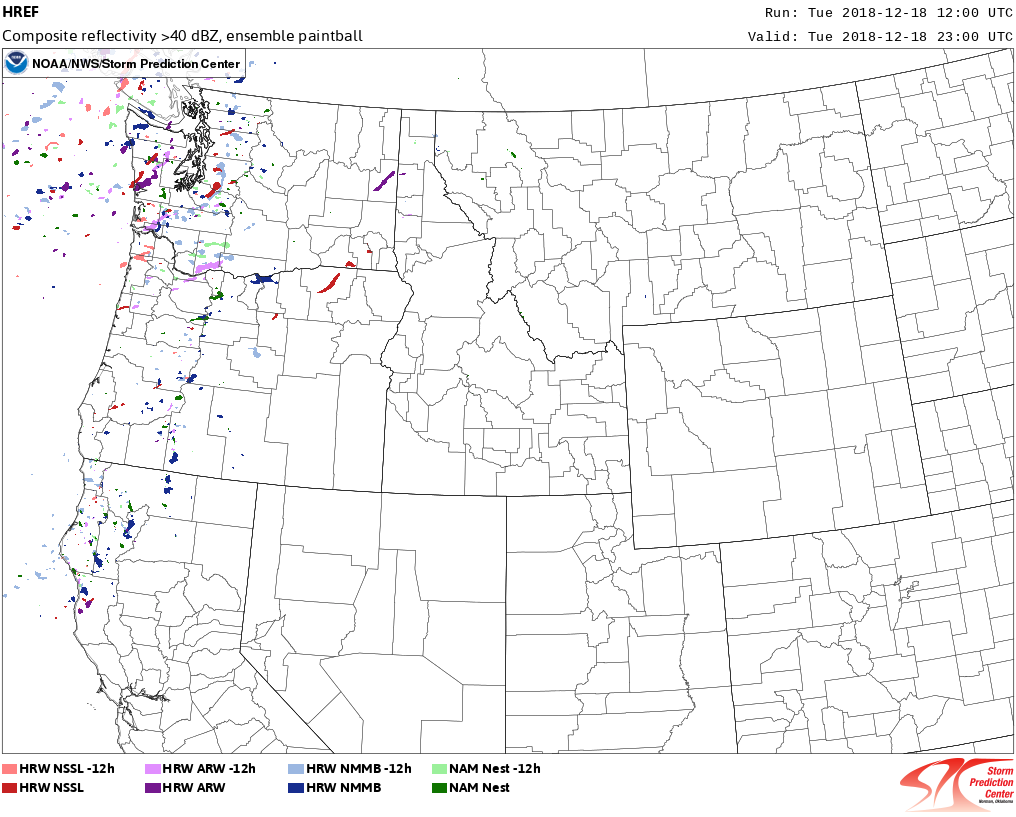
The HREF even showed that the fixed-layer sigTOR parameter would have an up to 30% chance of exceeding 1. However, most of the high probabilities were close to the coast where the CAPE was the highest. What happens inland was fracturing and lowering of probabilities. While not zero, it would be hard to have any confidence of a significant threat, at least significant enough to warrant a tornado outlook from the 12 UTC runs. And the updraft helicity forecast showed only one short-lived, low-value, plot in southwest Washington – hardly the kind of result that would promote anyone to raise the risk level.
 | |
|
 | |
|
No comments:
Post a Comment